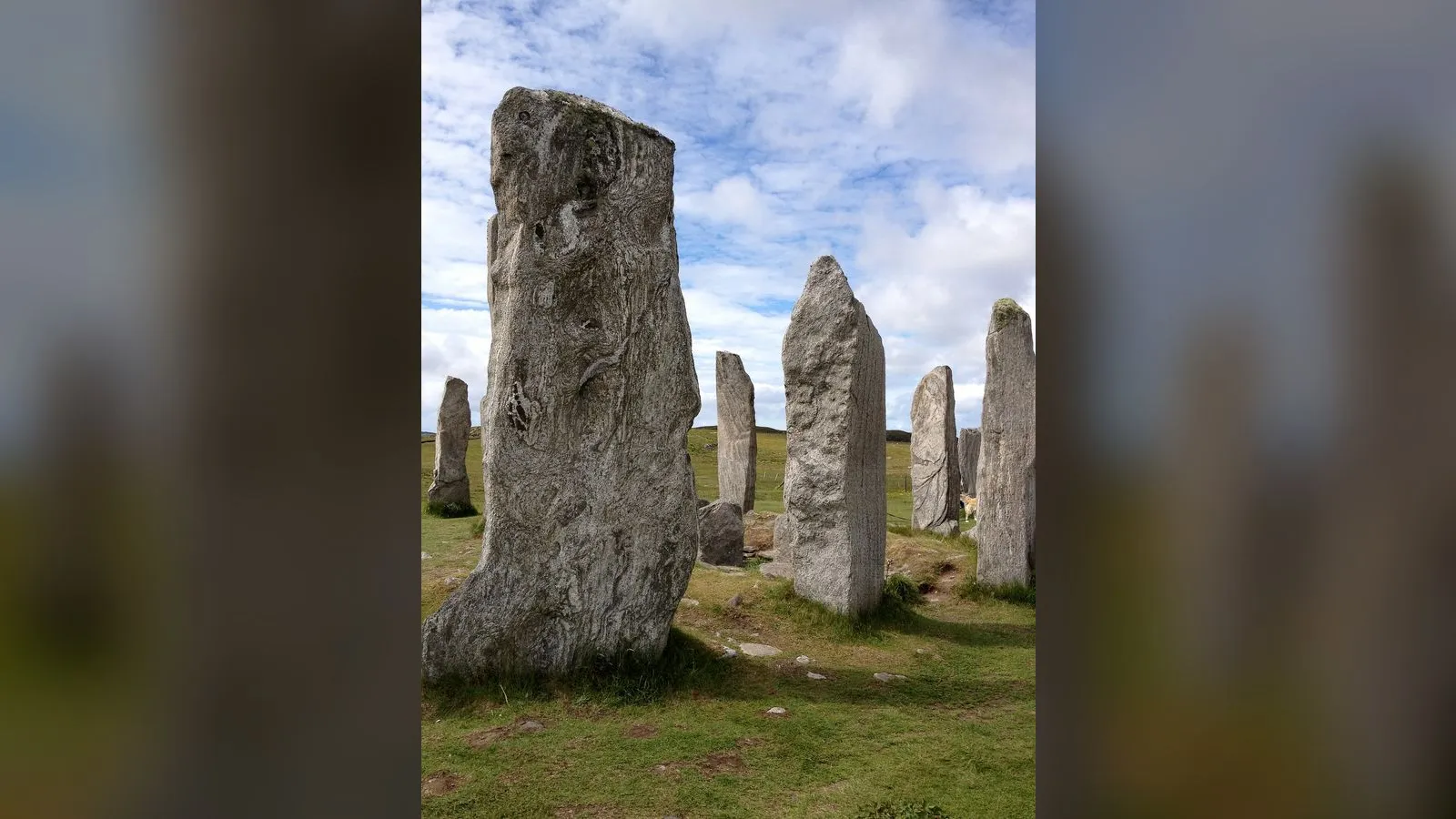

Calanais Standing Stones
Contents
Legend/Myth Opener
Calanais is frequently marketed as "Scotland's Stonehenge," and sometimes described with confident claims about ancient astronomers tracking the moon or sun with precise intent. The dating comparison to Stonehenge is fair — Calanais's main setting was likely erected slightly earlier. The confident claims about its purpose are not. No inscription, no surviving oral tradition reaching back far enough, and no unambiguous archaeological signature tells us why Neolithic people on Lewis built this extraordinary arrangement of stone. Every explanation on offer — astronomical observatory, ceremonial gathering place, ancestor shrine, territorial marker — is a theory, some better supported than others, none proven.
TL;DR
- established The main stone setting at Calanais was erected in the Neolithic period, broadly dated to around 2900–2600 BC, making it contemporary with or slightly earlier than the main sarsen circle at Stonehenge — this dating rests on archaeological excavation and peat stratigraphy, and is treated as reasonably solid. established
- established The site's layout is unusual and distinctive: a central stone circle around a tall monolith, with stone rows extending east, west and south, and a longer avenue of paired stones running north — this is a matter of direct physical survey, not interpretation. established
- disputed Calanais is popularly said to have been built as a precise lunar or solar observatory, aligned to track specific celestial events — this is stated as disputed because, while some alignments are statistically suggestive, archaeoastronomers disagree sharply over whether these are deliberate design or coincidence, and no consensus interpretation exists. disputed
- established A small chambered tomb was built within the stone circle at some point after the main setting was erected, and the site continued to see activity for roughly two millennia before gradually being buried under blanket peat by the Iron Age — these facts are drawn directly from excavation (1980s campaigns) and are well supported. established
- established The site is a Scheduled Monument managed by Historic Environment Scotland, with a visitor centre and community trust (Urras nan Tursachan) supporting access — this is a matter of public institutional record. established
Key Facts
- Location/Region
- Calanais (Callanish), Isle of Lewis, Outer Hebrides
- Era/Date
- Main setting erected c. 2900–2600 BC; site active into the Bronze/Iron Age; buried by peat by c. 1000–500 BC
- Type
- Neolithic stone circle, stone rows/avenue, and later chambered cairn
- Heritage/Protected Status
- Scheduled Monument (Historic Environment Scotland)
- Managed/Owned by
- Historic Environment Scotland, with Urras nan Tursachan (the local trust) operating the visitor centre
- Access/Visitor Notes
- Open year-round outdoors, free access to the stones; visitor centre with exhibition and café operates seasonal/variable hours — check current opening times before visiting
Scottish Impact Index (SI Score)
- National Significance
- 8/10
- Historical Continuity
- 10/10
- Human & Economic Importance
- 5/10
- Landscape / Architectural Distinctiveness
- 10/10
- Cultural & Historical Legacy
- 9/10
- Recognition
- 9/10
51/60
Ranked =31st of 43 in Locations
A Note on Claims and Evidence
The physical facts of Calanais — its layout, approximate construction date, the later chambered tomb, and the long span of activity before the site was buried under peat — are genuinely documented through controlled excavation, particularly the research campaigns of the late 1970s and 1980s. What is emphatically not documented is why it was built this way. Every claim about ritual purpose, astronomical function, or social meaning is, at best, a well-argued traditional or scholarly interpretation drawn from comparative archaeology and landscape analysis — and in several cases, such as specific lunar-alignment theories, it remains a genuinely contested hypothesis rather than an accepted finding. This article is deliberately cautious about that distinction throughout, because Calanais is exactly the kind of monument where popular writing routinely overstates certainty that professional archaeologists do not claim to have.
Timeline
Main stone setting at Calanais erected (central circle, stone rows, and the north-south avenue).
Continued use and modification of the site, including construction of a chambered tomb within the circle at some point in this period.
Blanket peat growth begins covering the lower portions of the stones, eventually burying much of the monument.
Local peat cutting removes accumulated peat around the stones, revealing their full original height for the first time in centuries.
Major modern excavation and survey campaigns investigate the stone ring, avenue, and chambered tomb, establishing much of the current chronological understanding.
Site designated a Scheduled Monument under UK/Scottish heritage protection.
Visitor centre established near the site, run with Urras nan Tursachan (the Calanais community trust), alongside ongoing conservation by Historic Environment Scotland.
One of the most visited prehistoric sites in the Outer Hebrides, within a wider landscape of at least 11 related stone settings.
Details
A monument built on an unusual plan
Calanais is not a simple circle. At its core stands a ring of standing stones around a single tall central monolith nearly five metres high, but radiating from that ring are stone rows running east, west, and south, and — most distinctively — a long avenue formed by two converging lines of stones running north from the circle for roughly 80 metres. This cruciform-like plan has no exact parallel elsewhere in Britain or Ireland, which is part of what has made Calanais such a magnet for interpretation. It was built in the Neolithic period, with current dating placing the main setting at roughly 2900–2600 BC — broadly contemporary with, and by some estimates slightly earlier than, the main sarsen stone phase at Stonehenge in England, though the two monuments are architecturally very different and should not be treated as versions of the same design.
What was it for? Genuinely unknown
This is the point at which caution matters most. Popular accounts frequently assert that Calanais was built as an astronomical observatory, tracking the rising and setting points of the sun, moon, or specific stars with deliberate precision — most famously tied to the Moon's roughly 18.6-year "lunar standstill" cycle, during which the Moon appears to skim along the southern hills near the site. This is a real and serious hypothesis, explored by archaeoastronomers since the 20th century, and some of the alignments are striking. But it is not an established fact. Archaeologists and archaeoastronomers remain divided over whether these alignments represent deliberate design, selective pattern-matching by modern observers working backward from what they expect to find, or simple coincidence given how many possible alignments exist among a complex arrangement of stones and the surrounding hill horizon. Other researchers argue the site's primary significance was social and ceremonial — a gathering place for dispersed Neolithic communities across Lewis and the wider Hebrides, its unusual visibility from land and sea (it sits prominently on a ridge) suggesting a role as a shared landmark and meeting point rather than, or in addition to, any precise astronomical function. No single theory commands consensus, and this article does not endorse one over the others.
Later use, burial, and rediscovery
At some point after the main setting was built, a smaller chambered tomb was constructed within the stone circle itself — a sequence that tells us the site's meaning or use changed over time, rather than remaining fixed from a single founding moment. Activity, in some form, appears to have continued at or around Calanais for close to two thousand years after its initial construction. By the early first millennium BC, however, the site had begun to be engulfed by the blanket peat that covers much of Lewis's landscape, gradually burying the lower sections of the stones and effectively taking the monument out of active use and visibility.
Calanais remained partly hidden under peat for roughly two and a half thousand years until 1857, when local peat-cutting removed the accumulated covering and revealed the stones' true original height for the first time in millennia — an important moment both for public awareness of the site and, much later, for archaeological study. The most significant modern excavation campaigns took place between 1979 and 1988, examining the stone ring, the avenue, and the internal chambered tomb in detail, and it is this work that underpins most of the dating and structural understanding used by archaeologists today.
Calanais today: landscape, protection, and tourism
Calanais is not an isolated monument but the centrepiece of a wider prehistoric landscape: at least eleven other stone settings of varying age and form survive within a few kilometres, suggesting a long-used ceremonial or socially significant area rather than a single one-off construction. The main site is a Scheduled Monument, protected and managed by Historic Environment Scotland, with day-to-day visitor engagement supported by Urras nan Tursachan, the local community trust, which operates a visitor centre with exhibition space and a café near the stones.
In Scottish cultural identity, Calanais occupies a distinctive place: it is one of the clearest physical demonstrations that the Outer Hebrides supported organised, technically capable communities in the deep Neolithic past, fully five thousand years before the present — a corrective to any assumption that the "remote" Hebrides were ever marginal to prehistoric Britain. At the same time, its enduring mystery is part of its appeal and its scholarly value: Calanais is regularly cited in archaeology precisely as a case study in how much remains genuinely unknown about Neolithic ritual and astronomical practice, and in how easily popular narratives can outrun the actual evidence. Any responsible modern account of the site should present its purpose as an open question, not a solved one.
Did You Know?
- The central stone circle at Calanais may be slightly older than the main sarsen circle phase of Stonehenge, based on current dating evidence.
- The site was partly buried under peat for roughly 2,500 years before local peat-cutting in 1857 revealed the stones' full height.
- A smaller burial chamber was built inside the main stone circle at some point after it was first erected — meaning the monument's use changed over the centuries, not just its surroundings.
- There are at least 11 other stone settings within the wider Calanais landscape, not just the famous main circle most visitors photograph.
- The long northern avenue of paired stones at Calanais has no exact architectural parallel at any other known British or Irish Neolithic site.
- The popular theory linking Calanais to the Moon's 18.6-year "lunar standstill" cycle is taken seriously by some archaeoastronomers but is actively disputed by others — there is no settled scholarly consensus.
- Major modern excavations at Calanais did not take place until 1979–1988, meaning much of what is now understood about the site is a relatively recent archaeological achievement.
- The monument sits prominently on a ridge visible from both land and sea for a considerable distance, which some researchers argue was itself part of its original purpose as a landmark.
FAQ
1How old are the Calanais Standing Stones?
The main setting was erected roughly 2900–2600 BC, in the Neolithic period, making it broadly contemporary with or slightly earlier than Stonehenge's main stone circle.
2Were the stones built as an astronomical observatory?
This is a seriously debated theory, particularly regarding lunar alignments, but it is not an established fact. Archaeologists disagree on whether the alignments were intentional.
3What is the strange avenue of stones for?
Its exact purpose is unknown; it may have been a processional route, a ceremonial approach, or served some other social function — no definitive explanation exists.
4Is there a burial tomb at Calanais?
Yes — a small chambered tomb was built within the main stone circle at some point after its initial construction.
5Why were the stones partly buried?
Blanket peat gradually grew up around the lower sections of the stones over roughly two millennia, largely covering them by the early first millennium BC.
6When were the stones rediscovered at full height?
Local peat-cutting in 1857 removed the accumulated peat and revealed the stones as they stand today.
7Is Calanais older than Stonehenge?
The main stone setting is dated to a broadly similar or slightly earlier period than Stonehenge's main sarsen circle phase, though the two sites are very different in form and should not be treated as equivalent monuments.
8How many stone circles are there at Calanais?
The main circle is the most famous, but at least 11 other related stone settings survive in the surrounding landscape.
9Can you visit the stones freely?
Yes, outdoor access to the stones themselves is free and unrestricted; the nearby visitor centre operates its own seasonal hours.
10Who manages the site?
Historic Environment Scotland manages the scheduled monument, with the local trust Urras nan Tursachan running the visitor centre.
11Is Calanais connected to any legends or folklore?
Local Gaelic tradition has associated the stones with various folk explanations over the centuries, but these are traditional stories rather than historical evidence of the monument's original purpose.
12Why is the site significant to Scottish history?
It demonstrates that organised, technically capable Neolithic communities were active in the Outer Hebrides around 5,000 years ago, and remains one of Scotland's most studied and visited prehistoric sites.
Sources and Further Reading
Primary/Institutional
- Historic Environment Scotland — Calanais Standing Stones: History
- Urras nan Tursachan (Calanais Visitor Centre) — site and visitor information
Scholarly/Critical
- Archaeological excavation reports from the 1979–1988 Calanais research campaigns
- Academic archaeoastronomy literature discussing and disputing lunar/solar alignment theories at Calanais
General
- Wikipedia — Callanish Stones
- VisitScotland and Visit Outer Hebrides — visitor information for Calanais
Caveats: Myths and Disputed Claims
- Do not state that Calanais was built as an astronomical observatory, or that specific lunar/solar alignments were deliberate, as established fact — this remains a genuinely contested theory among archaeoastronomers.
- Avoid flatly declaring Calanais "older than Stonehenge" without qualification; current dating places the main settings in a broadly similar period, with Calanais's main setting possibly slightly earlier, but both involve dating ranges, not precise single dates.
- Do not present any single theory of the site's ritual or social purpose (ceremonial gathering place, ancestor shrine, territorial marker, observatory) as the accepted explanation; none has scholarly consensus.
- Avoid implying the monument has always looked as it does today; it was substantially buried under peat for roughly two and a half millennia before 1857.
- Do not treat local folklore or legendary explanations of the stones as historical evidence of their original Neolithic purpose.
Card 041 · Locations