
Loch Tay & Highland Perthshire
Contents
TL;DR
- established Loch Tay is a 23.42 km (14.55 mile) freshwater loch reaching 154.8 m deep, flanked by Ben Lawers, the tenth-highest mountain in the British Isles — these are measured physical facts, not estimates, so stated plainly.
- established More than 20 crannogs (artificial or part-artificial loch dwellings) have been identified in Loch Tay, with several Iron Age examples radiocarbon-dated between roughly 810 BC and AD 640 — this rests on published archaeological dating evidence, not tradition.
- established The original reconstructed crannog at the Scottish Crannog Centre burned down in 2021, destroyed in roughly six minutes; a new, larger reconstruction opened on the opposite shore in May 2026 — both the destruction and the rebuild are recent, well-documented events, confirmed via fresh search rather than assumed.
- established The Campbell earls and marquesses of Breadalbane dominated the loch's watershed from around 1600 to the late nineteenth century and oversaw clearances that removed an estimated two-thirds of the local population — this is documented social history and is stated directly rather than softened.
- disputed Some popular accounts imply the original crannog reconstruction's loss was simply an "accident"; the cause has been described in varying terms across coverage, so this article does not assert a single definitive cause without further primary confirmation.
Key Facts
- Location/Region
- Highland Perthshire, straddling the Perth and Kinross / Stirling boundary, historic province of Breadalbane
- Scale
- 23.42 km (14.55 miles) long, up to 154.8 m (508 ft) deep, roughly 1–1.5 miles wide. Ben Lawers: 1,214 m
- Type
- Freshwater loch with associated mountain and settlement landscape
- Protected/heritage status
- Ben Lawers: National Nature Reserve (National Trust for Scotland); multiple crannog sites recorded by Historic Environment Scotland/Canmore; Scottish Crannog Centre is a Museums Galleries Scotland-recognised "nationally significant" collection
- Managed/owned by
- Mixed private estates, National Trust for Scotland (Ben Lawers), Scottish Crannog Centre (independent charitable trust)
- Access notes
- Road (A827) runs along the north shore; Kenmore at the outflow is the main village; crannog sites largely visible only via boat tour or the reconstructed example at the Crannog Centre
Scottish Impact Index (SI Score)
- National Significance
- 7/10
- Historical Continuity
- 10/10
- Human & Economic Importance
- 7/10
- Landscape / Architectural Distinctiveness
- 9/10
- Cultural & Historical Legacy
- 9/10
- Recognition
- 7/10
49/60
Ranked =34th of 43 in Locations
A Note on Claims and Evidence
Loch Tay's physical dimensions and the radiocarbon dating of its crannogs are documented, resting on survey measurement and published scientific dating respectively. The social history of the Breadalbane Campbells' clearances is also documented through estate and population records, even though precise population figures vary somewhat between sources. By contrast, some of the older folklore attached to individual crannog sites, and certain narrative framings of "daily life" at Iron Age crannogs offered by heritage interpretation, are traditional/reconstructed — informed by archaeology but necessarily involving reasonable inference rather than direct record, since no written account of crannog life survives from the period. This article flags that distinction where it matters.
Timeline
Crannogs built and used around Loch Tay; more than 20 examples eventually identified by archaeologists, several radiocarbon-dated between roughly 810 BC and AD 640.
The loch's watershed develops as the historic province of Breadalbane, with control passing among clans including the Macnabs, Menzies, Drummonds, Napiers, MacGregors, and Robertsons.
The Campbell earls and later marquesses of Breadalbane establish dominant control over the loch and surrounding lands.
Clearances carried out under Breadalbane Campbell landownership remove an estimated two-thirds of the local population from the watershed.
The Scottish Crannog Centre is established at Kenmore, including a reconstructed Iron Age crannog built on the loch, based on archaeological excavation of a submerged original.
The original reconstructed crannog burns down, destroyed in approximately six minutes.
Construction begins on a new reconstructed crannog at a larger site on the opposite shore of Loch Tay.
The new Scottish Crannog Centre, roughly twelve times the size of the original site, is officially unveiled by Scotland's First Minister.
Details
A deep trench beneath a high mountain
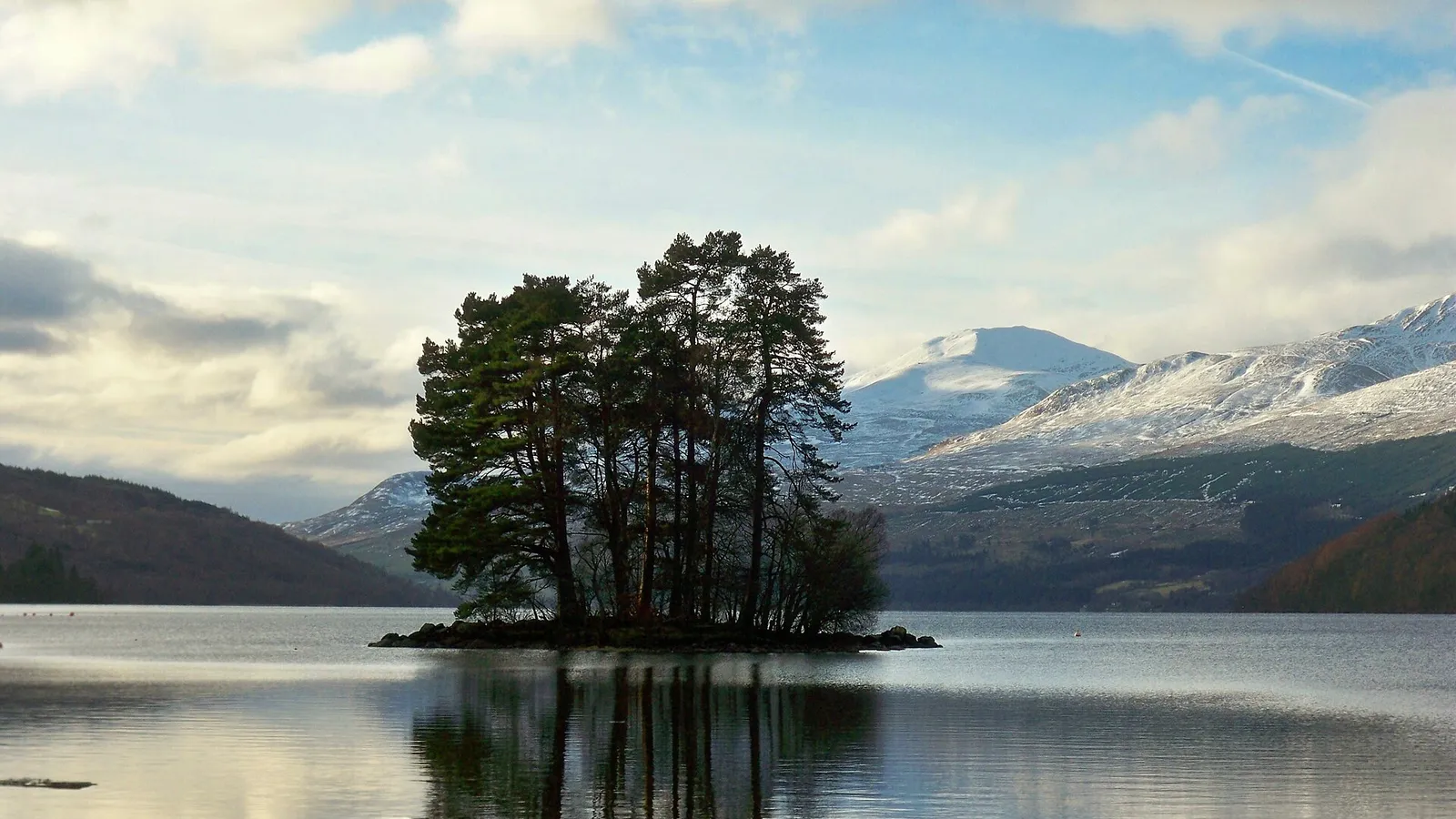
Loch Tay occupies a long, narrow glacial trench in the heart of Highland Perthshire, running over 23 kilometres from Killin at its western end to Kenmore, where the River Tay flows out, at its eastern end. At up to 154.8 metres deep, it is one of Scotland's deeper lochs, and it sits beneath Ben Lawers, which at 1,214 metres is the tenth-highest mountain in the British Isles and the highest point among a cluster of seven munros on the loch's northern shore. The Ben Lawers massif is managed as a National Nature Reserve by the National Trust for Scotland, protecting one of Britain's most significant concentrations of rare alpine plant life, a product of the area's unusual mix of calcium-rich rock and high altitude.
Crannogs: genuine Iron Age settlement, carefully reconstructed
Loch Tay holds one of the densest known concentrations of crannogs in Scotland — more than twenty have been identified by archaeological survey, submerged or partially submerged structures built on piles or stone foundations just offshore, used as defensible or simply practical waterside dwellings. Radiocarbon dating of timber from several Loch Tay crannogs places their construction and use across a remarkably long span, from around 810 BC into the early medieval period around AD 640, indicating the technique was not a single Iron Age fashion but a loch-dwelling tradition sustained for well over a thousand years.
Because a crannog is, by its nature, a wooden and organic structure sitting in water, very little survives above the waterline at most sites; what we know of how people built, lived in, and used these structures comes from careful underwater and shoreline excavation, not from written record (the Iron Age in this part of Scotland predates any surviving contemporary written description of local life). Any reconstruction, however well-researched, therefore necessarily involves informed inference about details such as roofing material, wall construction, and daily use, built from archaeological evidence rather than direct eyewitness account — a distinction the Scottish Crannog Centre's own excavation-based research explicitly works to make transparent.
The 2021 fire and the 2026 rebuild
The reconstructed crannog that stood at Kenmore for nearly three decades, built following excavation of a genuine submerged Iron Age crannog in the loch, burned down in 2021. Reports describe the fire destroying the timber-and-thatch structure in roughly six minutes — an illustration, incidentally, of exactly how vulnerable the original Iron Age structures would also have been to fire, a risk their Iron Age builders certainly knew and managed, even if we cannot know precisely how.
Rather than simply rebuild on the same small original site, the Scottish Crannog Centre relocated to a larger site on the opposite shore of Loch Tay, beginning construction of a new reconstructed crannog in October 2024. The new 15-metre-diameter structure, built on stilts in the loch with an approach walkway, was unveiled on 22 May 2026 by Scotland's First Minister, as part of a wider site roughly twelve times the area of the original. The project, costing around £5 million for the relocation and a further £700,000 for the crannog reconstruction itself, was funded through a combination of the National Lottery Heritage Fund, Perth and Kinross Council, Historic Environment Scotland, and other trusts, and the centre's collection has since been recognised by Museums Galleries Scotland as nationally significant. Readers researching this site should be aware the rebuild is a genuinely recent development, not an assumption carried over from the original site's older reputation.
Clan power, Breadalbane, and depopulation
Loch Tay's watershed traditionally forms the historic province of Breadalbane, and its landholding history is a clear illustration of how control over Highland territory shifted over the centuries. Earlier periods saw land held by a changing mix of clans — the Macnabs, Menzies, Drummonds, Napiers, MacGregors, and Robertsons among them — before the Campbells, as earls and later marquesses of Breadalbane, established dominant control over the loch and its surrounding lands from around 1600 through to the late nineteenth century.
That dominance came at a severe human cost that this article states plainly rather than passing over: clearances carried out under Breadalbane Campbell estate management are documented to have removed an estimated two-thirds of the local population from the watershed over the course of the clearance era, as communities were displaced to make way for large-scale sheep farming and estate reorganisation. This is not a marginal footnote to Loch Tay's history; the loch's present-day sparse settlement pattern, scattered small villages set against a largely depopulated hinterland, is a direct, documented legacy of that process, not simply a natural feature of a "remote" landscape.
established The MacGregors were among the losers in that contest. The historian David Stevenson, in The Hunt for Rob Roy (2004), describes how Clan Gregor expanded into Breadalbane in the fourteenth century, was losing ground to the Glenorchy Campbells by the later fifteenth, and had largely been driven from its better lands by the mid-sixteenth. Breadalbane's Campbell earls later used scattered MacGregors as clients: the first earl was Rob Roy MacGregor's patron, and Rob wrote to his estate officers from Taymouth in 1699. Finlarig, at the head of the loch by Killin, served as a government base. Troops marched from there in September 1716 to hunt Rob Roy, and on 8 October 1725 it was the scene of a mass surrender of arms to General Wade's officers by men of Breadalbane and Atholl, Macnabs, Menzies and Campbells. The receipts record twenty guns and twenty-one broadswords received from Rob Roy, who came in with about forty MacGregors and their piper before making his submission to Wade.
Tourism, scenery, and national identity today
Today Loch Tay functions as one of Highland Perthshire's central tourism landscapes, combining lake and mountain scenery, water sports, and heritage tourism anchored by the rebuilt Crannog Centre, which presents genuine Iron Age archaeology in an accessible, hands-on form distinct from the more purely scenic appeal of the loch itself. Its position within Scotland's national self-image sits somewhat differently from more globally famous lochs: Loch Tay is less a symbol exported abroad (unlike Loch Lomond or Loch Ness) and more a working example, for a domestic and specialist audience, of continuous human settlement and adaptation around a single body of water across several thousand years — Iron Age crannog-dwellers, medieval clan society, Campbell-era estate control and clearance, and now twenty-first-century heritage tourism, layered on the same shoreline.
Gaelic Perthshire
established Highland Perthshire was strongly Gaelic-speaking until the late nineteenth century. The historical geographer Charles Withers, in Gaelic in Scotland 1698–1981 (1984), uses estate surveys of the 1750s to show that only about 15 to 20 per cent of people in upland parishes such as Blair Atholl and Fortingall spoke English, while in parts of Rannoch only Gaelic was preached. Young people learned English by going to work in the Lowlands: at Killin in 1796, they made "a practice, when young, of going for several years to serve in the low country, principally for the purpose of learning the English language".
established Gaelic kept its place in church longest. In 1842 the minister of Dull wrote that his congregation seemed "apparently indifferent during the English service" but were "all eyes and attention during the Gaelic", and in 1843 the minister of Killin called it "the language of devotion and of the affections of the people". In 1881 more than three-quarters of the people in Fortingall, Killin and Kenmore still spoke Gaelic. After that it declined faster in Perthshire than almost anywhere: by 1971 fewer than 2 per cent of the county's people spoke it.
Did You Know?
- The original reconstructed crannog at the Scottish Crannog Centre burned down in just six minutes in 2021.
- A new, much larger crannog reconstruction opened on the opposite shore of Loch Tay in May 2026, unveiled by Scotland's First Minister.
- More than 20 crannogs have been identified in Loch Tay — one of the densest concentrations of these ancient loch-dwellings anywhere in Scotland.
- Radiocarbon dating shows Loch Tay crannogs were built and used across more than a thousand years, from around 810 BC into the early medieval period.
- Ben Lawers, overlooking the loch, is the tenth-highest mountain in the British Isles.
- Loch Tay's watershed is estimated to have lost roughly two-thirds of its population to Highland Clearances carried out under Campbell of Breadalbane estate ownership.
- The new Crannog Centre site is roughly twelve times the physical size of the original Kenmore location.
- No written account of Iron Age crannog life survives from the period — everything we know comes from archaeological excavation, not historical record.
FAQ
1Is the Scottish Crannog Centre still open?
Yes — after the 2021 fire destroyed the original reconstruction, a new, larger crannog and visitor centre opened on the opposite shore of Loch Tay in May 2026.
2What happened to the original crannog?
It burned down in 2021, destroyed in roughly six minutes.
3How many crannogs are in Loch Tay?
More than 20 have been identified by archaeological survey, with several radiocarbon-dated across a span of well over a thousand years.
4How deep is Loch Tay?
Up to about 154.8 metres (508 feet) at its deepest point.
5How long is Loch Tay?
Approximately 23.42 km (14.55 miles).
6What is Ben Lawers?
The mountain overlooking Loch Tay's north shore, at 1,214 metres the tenth-highest peak in the British Isles, now a National Trust for Scotland Nature Reserve known for rare alpine plants.
7Were people really cleared from around Loch Tay?
Yes — clearances under Breadalbane Campbell estate ownership are documented to have removed an estimated two-thirds of the watershed's population.
8Who controlled Loch Tay historically?
Various clans held land over time, but the Campbell earls, later marquesses, of Breadalbane dominated from around 1600 to the late nineteenth century.
9What is a crannog, exactly?
An artificial or part-artificial island or platform built in a loch, often on wooden piles, used as a defensible or practical dwelling site from the Iron Age through to the early medieval period and sometimes later.
10Can you visit a crannog on Loch Tay?
Yes, via the reconstructed example at the Scottish Crannog Centre, built using evidence from excavation of a genuine submerged original.
11What village is at Loch Tay?
Kenmore sits at the loch's outflow into the River Tay; Killin lies at the opposite, western end.
12Is Loch Tay connected to the Harry Potter viaduct or St Columba's Iona?
No — those belong to separate landscapes and separate cards in this collection; Loch Tay's distinct story is crannog archaeology and Breadalbane clan history.
Sources and Further Reading
Primary/Institutional
- National Trust for Scotland — Ben Lawers National Nature Reserve
- Historic Environment Scotland / Canmore — crannog site records for Loch Tay
- National Lottery Heritage Fund — Scottish Crannog Centre case study
- Scottish Parliament — motion celebrating the Scottish Crannog Centre reopening
Scholarly/Critical
- Society of Antiquaries of Scotland (journals.socantscot.org) — crannog excavation and dating research
- EXARC Journal — "The Scottish Crannog Centre: Sustainable Thinking through Time and Place"
- David Stevenson, The Hunt for Rob Roy: The Man and the Myths (John Donald, 2004)
- Charles W. J. Withers, Gaelic in Scotland 1698–1981: The Geographical History of a Language (John Donald, 1984; ebook Birlinn, 2021)
General
- Wikipedia — "Loch Tay"
- Museums Association — coverage of the Scottish Crannog Centre's new building (2026)
- The Courier — local coverage of the Crannog Centre rebuild
Caveats: Myths and Disputed Claims
- Do not describe the Scottish Crannog Centre's reconstructed crannog as itself an original Iron Age structure — it is a modern, evidence-based reconstruction. Correct phrasing: "a reconstruction built from archaeological evidence of a genuine submerged original."
- Do not state a single definitive cause for the 2021 fire unless a primary investigative source is cited — coverage of the cause is not consistently detailed. Correct phrasing: "destroyed by fire in 2021, in a blaze reported to have taken around six minutes."
- Do not present reconstructed details of "daily crannog life" shown in heritage interpretation as directly recorded fact — no written account from the period survives. Correct phrasing: "based on archaeological inference, since no contemporary written record exists."
- Do not minimise or omit the Breadalbane clearances when discussing Loch Tay's landownership history — treat the population loss as a stated, documented fact, not an incidental aside.
Card 024 · Locations